
This unique project brought together specialists in GIS, web development, and digitization to create an interactive website based on Dick J. Reavis ’s 1987 year long journey driving every highway in Texas.
Dick J. Reavis is the award-winning author of seven books, including The Ashes of Waco: An Investigation; If White Kids Die: Memories of a Civil Rights Movement Volunteer; Catching Out: The Secret World of Day Laborers and more. He has been a Nieman Fellow at Harvard University, a Senior Editor at Texas Monthly, and a finalist for a National Magazine Award. He is now Emeritus Associate Professor of English at North Carolina State University. While on assignment for Texas Monthly in the late 1980s, Mr. Reavis got lost and pulled from his glove box his official Texas Highway map. Looking at the map, the thought occurred to him, “there sure are a lot of roads on that map … I wonder if anyone has ever driven them all.” He decided he would try.
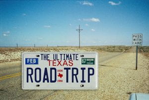
He proposed to Texas Monthly that he spend a year driving every single road on the map and write a series of articles for the magazine about his experiences. Mr. Reavis divided Texas into 48 Regions and drove over 117,000 miles in a Chevy Suburban. The Dick J. Reavis Papers at the Wittliff Collections contain thousands of photographs, postcards, notes and even a logbook chronicling each day’s driving. Mr. Reavis published fourteen articles in Texas Monthly throughout his tour.
Our exhibit contains digitized photographs, postcards, notes and copies of the articles as they appeared in Texas Monthly. We decided to digitize his original hand-shaded map, overlay it on Google Maps, and use that as the foundation for navigating the online exhibit. The exhibit also features a new video interview with Mr. Reavis and a collection of photographs from 1987 matched with corresponding images from Google Maps demonstrating the changing landscape of rural Texas during the last three decades.
We decided to use Omeka as the primary platform and use the Google Maps API and JavaScript to integrate the geospatial features. The first part of the process was digitizing Reavis’s 67 x 90 cm Texas Highway map with the RCAM and Phase One digital back. Nathaniel Dede-Bamfo, GIS Specialist, used this to create KML layers. The difficulty in this part of the project is that Reavis created his own regions. Although they often followed county boundaries and rivers, they often included only parts of counties. Nathaniel pulled data from the US Census Bureau and the Texas Natural Resources Information System (TNRIS) into ArcGIS to perform Geo referencing, Editing & Dissolving, and Symbolizing. Nathaniel then converted the layers to KML files.
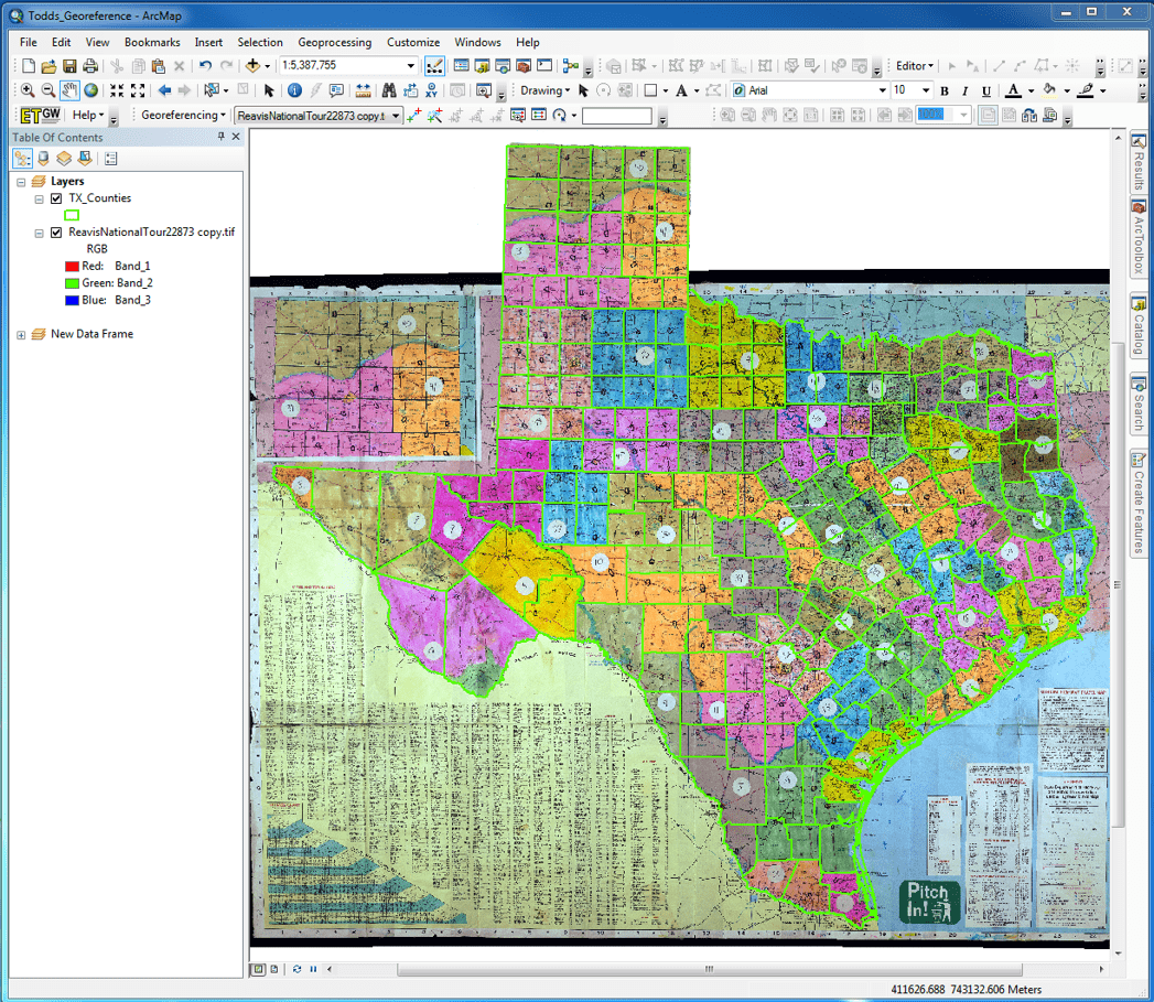
Geo referencing

Symbolizing
Our programmer Jason Long, then used two KML files created by Nathaniel to create a custom page in Omeka using the Google Maps API. The first KML was an image overlay of Reavis’s digitized shaded map and the second KML was a series of polygons for Reavis’s regions.Since the Google API does not generate a mouse over event for polygons when loading a KML layer, Jason used the geoxml3 extension as a KML processor for use with Version 3 of the Google Maps JavaScript APS. First he generated a map with the Google API with javascript. Next he parsed the KML polygon layer with geoxml3 and finally used AJAX to create links to items in the Omeka Exhibit based on mouse events.
Putting it all together, Jason created a custom theme in Omeka and used the Unite Gallery javascript for the slide shows.
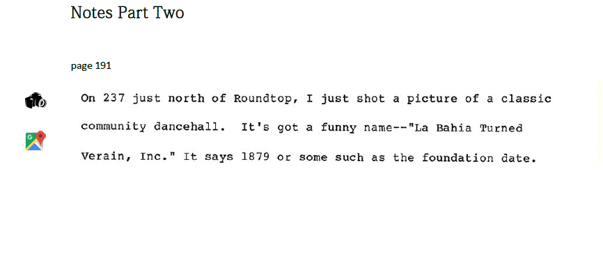
We thought it would be interesting to try to show some of the changes since Reavis’s tour. We pulled some excerpts from his tour notes and added links to photos he took at the time and also links to current Google Maps Street Views of the same locations.
 One of Dick Reavis’s motivations for making the tour was to try to view a part of Texas that he knew would soon disappear. The then and now photos show that he was unfortunately correct in his prediction.